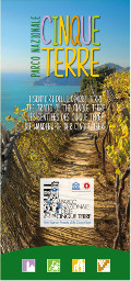
Parco Nazionale delle Cinque Terre
www.parconazionale5terre.itThe Cinque Terre Paths
Map guides of the Park
The new map guide, created in graphic coherence with the REL posters along the tracks, shows the richness of the Park's hiking network and is aimed at trekking lovers who, through this intuitive and easy-to-consult tool wil be able to plan better their outdoor itineraries in the Cinque Terre.The map presents not only more technical information on the paths divided section by section (difference in height, length, difficulty and travel time), but also useful information on the territory (services available to hikers and some advice to experience the beauties of the landscape in a correct way).
- Year: 2023
- Scale: 1:35.000
- Text language: ItalianoEnglishDeutschFrançais

The Cinque Terre Paths
© 2024 - Ente Parco Nazionale delle Cinque Terre


