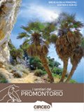
The Promontory Paths
A short guide of the main itineraries and services
The Circeo Promontory, formerly an island, is today a small and isolated limestone-dolomitic mountain massif (541 mt. asl) which rises from the Pontine plain and delimits the Circeo National Park to the north. The promontory massif is divided into two main sides, depending on the exposure, called Quarto Caldo and Quarto Freddo and represents an important treasure chest of biodiversity. The trail network of the Circeo Promontory extends for 21 km in a very suggestive and fascinating environment crossing the entire promontory and connecting the areas of greatest interest and naturalistic value present in the area. Through this network you could reach places of great historical and cultural value, such as the historic center of San Felice Circeo, the Acropolis of the Circei with its Cyclopean walls, the sixteenth-century coastal fortifications of Torre Paola and Torre Fico or the Napoleonic outpost of "Batteria" at the foot of the promontory, directly on the sea. In addition to places of considerable historical value, surrounded by an aura of mystery and legend, you could pass through natural environments of great ecological and landscape value. You could pass from holm oak and cork oak forests, with the presence of centennial tree specimens, to the typical Mediterranean scrub and every step along the path reveals new panoramic views and could be an opportunity to observe the fauna that inhabits them.- 750 Sentiero del Picco di Circe
- 751 Sentiero dell'Uliveto
- 754 Sentiero delle Mura Ciclopiche
- 755 Sentiero del Brecciaro
- 756 Sentiero di Guardia Orlando
- 757 Sentiero Torre Fico - La Batteria

The Promontory Paths
© 2024 - Ente Parco Nazionale del Circeo


