Pian Cavallone Refuge - Alpe Scaredi
- Trail Conditions: On foot
- Duration: 10-12
- Difficulty Level: EEA - For expert hikers with equipment
- Accomodation structures: Rifugio Pian Cavallone, Bivacco Alpe Scaredi
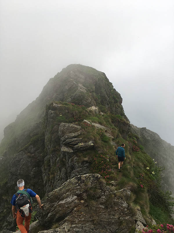
It is the longest and most demanding stage. From Pian Cavallone you reach the Marona (2051mt.) passing through the so-called "Scala santa" and the narrow passage called Passo del Diavolo, places equipped with iron chains, iron bolts and handrails. Remaining on the ridge, head towards the Zeda (2156mt.) and then descend the northern ridge for a few tens of meters, equipped with iron chains, to be used with mountaineering techniques and, after a ledge, you will come across a stairway of leaning stone slabs.
2° giorno: The Bove path
Accommodation: Rifugio Pian Cavallone, Bivacco Alpe Scaredi
To a subsequent carving, leave the deviation to Alpe Fornà on the right to continue on the sharp ridge bypassing the numerous spikes of rock that dot it with a tiring path. The trail then climbs up the Piota ridge (1925mt, path for Gurro and Falmenta). On the slope of Pogallo the trail runs downhill along the ridge that descends, with steep grassy slides, to the Passo delle Crocette (1781mt). The trail further loses altitude at the head of the Val Pogallo, running under rocky cliffs, and, arriving under Mount Torrione (where the deviation that in about 45 minutes leads to the Lideshow bivouac), enters a canal. A first section equipped with chains allows to climb on rock slabs to then cross a steep grassy slide invaded by green alders. Above, a long traverse is secured in several points by chains, as well as the last rocky channel leading to the summit (1984mt). The path descends rapidly on the side of Pogallo cutting the steep mountain slope to overcome some rock jumps and go up with a long diagonal to the Bocchetta di Terza (1836mt) where it meets the route that connects Cicogna with Finero (possibility to descend to the bivouac at Alpe Pian di Boit (1123mt) on a marked trail). The path goes down again on the side of the Val Pogallo to get around the southern buttresses of the Towers of Terza and then go up to a nozzle; descend briefly into the Finero valley from where you go up again to a notch at the foot of the eastern ridge of the Cima Marsicce (2135mt) which is reached with a tiring climb. Descend for a short distance to the comfortable western ridge and then cross the Bocchetta di Cortechiuso (2066mt. from where, through a path that overlooks the Val Loana, you descend to Alpe Scaredi (1841mt).
Overnight stay:
1. Alpe Lidesh open bivouac (1590mt)
2. Alpe Cortechiuso open bivouac (1883mt)
Today the Bove Trail is a path that can be completed in three to four days. Since this is a ridge itinerary, it must be walked very carefully and possibly accompanied by an Alpine Guide.
The variability, in relation to the weather and the season, of the visibility and the conditions of the soil, make its use difficult and risky, also considering that, besides M. Zeda, the work of maintenance of the path and of signage restoration are not yet carried out.


